Edit
The Edit module groups the structure editing actions: registration of blocks on the reference cloud, threshold-based filtering, safe deletion, grouping by panel or package, and assignment of plot numbers from a placement plan.
This is the tab where the correction and refinement work happens
once a structure has been loaded (from JSON) or detected automatically
(via Find blocks in a point
cloud).
Register selection - Adaptive dist
Shortcut: Ctrl+E
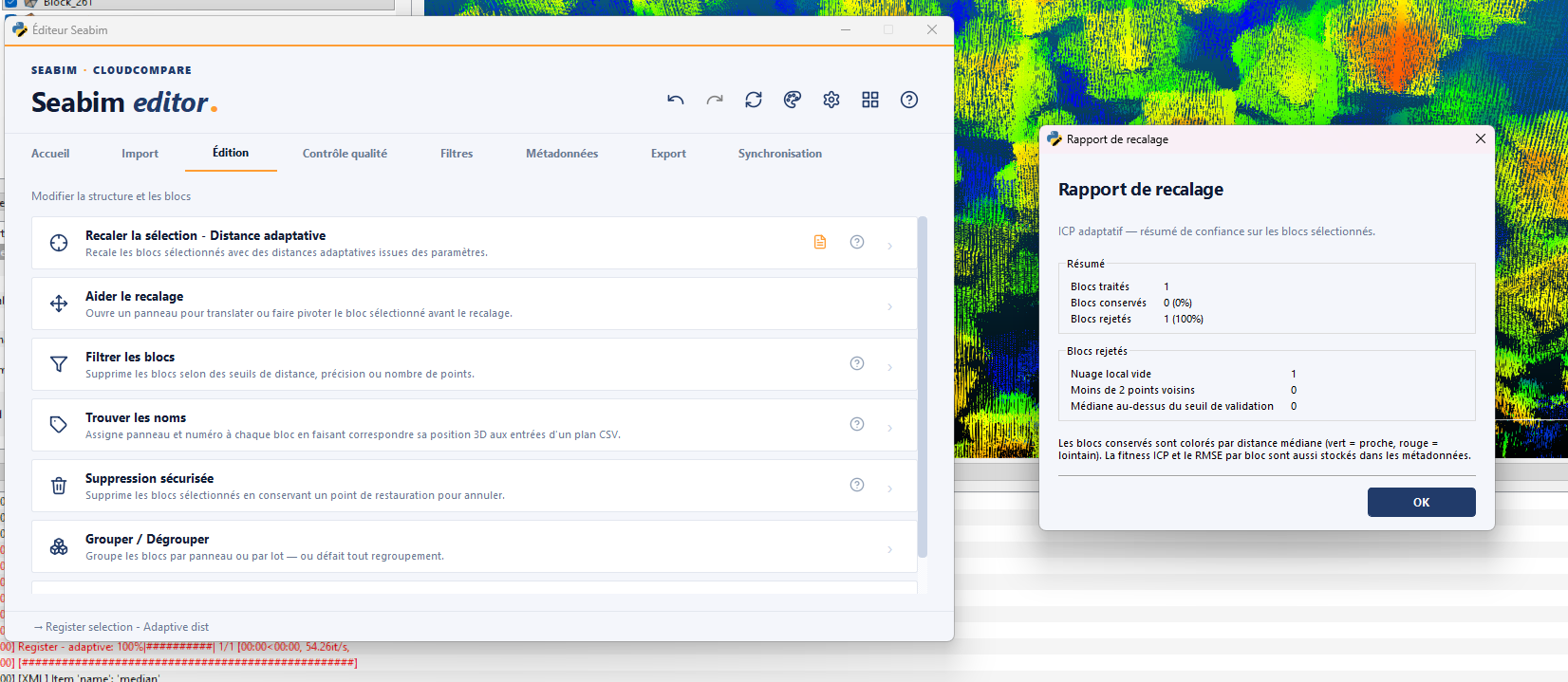
Realigns (registration) the selected blocks on the reference point cloud using adaptive distances defined in the project parameters. Each block is adjusted independently to minimise its distance to the cloud.
To use after automatic detection or after manually moving a block, to refine its position.
The action exposes a Registration report badge to the right of the
button:
- Enabled: a report detailing the moves (translations, rotations, scores) opens automatically at the end of each registration.
- Disabled: no pop-up, but clicking the badge re-enables it and shows the last report produced in this session.
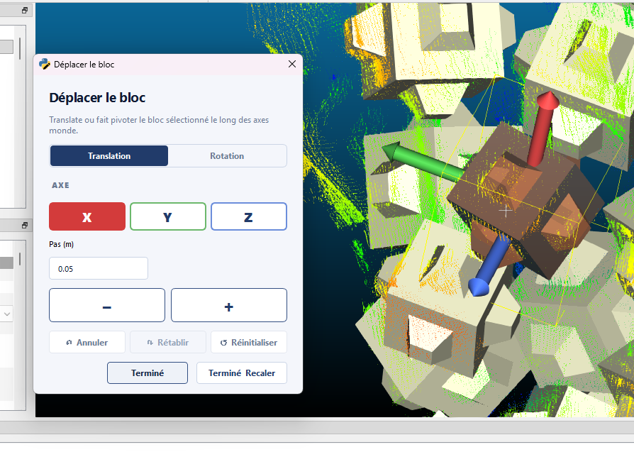
Help register
Opens an interactive panel that lets you translate or rotate the selected block before running the registration. Useful when a block's starting position is too far from the cloud for the automatic registration to converge.
Typical workflow:
- Select the block to pre-position.
- Click
Help register. - Use the arrows / sliders to move the block close to its theoretical position on the cloud.
- On validation, the
Register selection - Adaptive distaction is run automatically.
Filter blocks
Removes blocks that do not meet quality thresholds: median distance to the cloud, accuracy, or point count of correspondence.
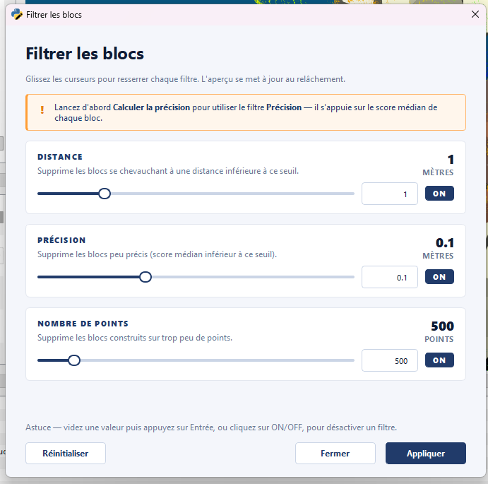
Dialog parameters:
| Parameter | Description |
|---|---|
Score threshold |
Upper threshold on the median of point distances around the block, in meters. Blocks whose score exceeds the threshold are removed. |
Distance threshold |
Threshold on the distance between block centers, in meters. If two blocks are closer than this threshold, the one with the lowest median distance is kept. |
Accuracy threshold |
Threshold on accuracy (quality scalar field). Blocks below are removed. |
First filtering after detection
This action is typically used right after automatic detection to eliminate false positives before manual registration.
Find names
Assigns the plot and block numbers of the blocks by matching each block's 3D position to a placement plan in CSV format.
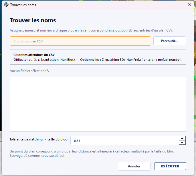
Dialog parameters:
| Parameter | Description |
|---|---|
Reference plan |
Path of the placement plan CSV used to name the blocks. |
Plan format |
Format of the plan (expected columns). |
Max distance |
Maximum distance, in meters, between a block's center and the matching point on the plan. Past that, the block is "off plan". |
Change only blocks without name |
Only update plot/block numbers for blocks that are not yet numbered. |
Offset for renamed block number |
If set, the assigned block numbers form a sequence starting at this value. |
Plot name for blocks outside the plan |
Plot name given to blocks whose distance to the plan is greater than Max distance. |
Safe delete
Removes the selected blocks while keeping an undo checkpoint. Unlike
direct deletion via CloudCompare, this action lets you roll back via the
Undo button of the Header.
Group / Ungroup
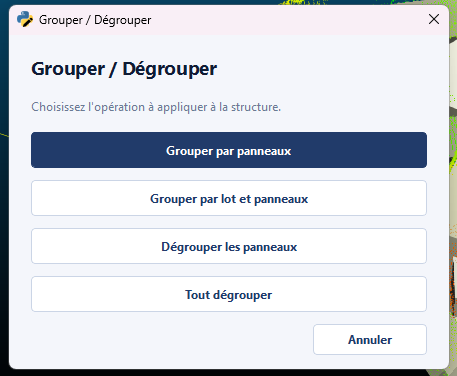
Reorganises the display of the structure in CloudCompare's tree by grouping blocks by panel or package, or ungrouping existing groups.
A single dialog exposes the 4 operations:
| Operation | Effect |
|---|---|
Group panels |
Groups blocks sharing the same plot_number into a panel subgroup. |
Ungroup panels |
Splits panel groups and moves the blocks back to the top level. |
Group packages |
Groups blocks sharing the same package. |
Ungroup all |
Splits every grouping (panel + package). |
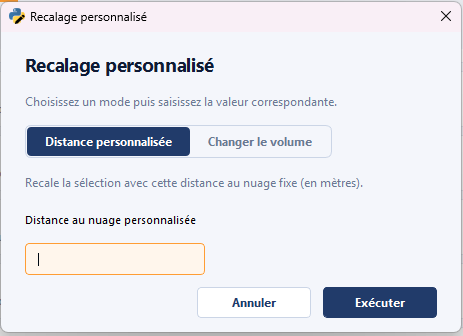
Register selection - Custom
Variant of the registration that lets you:
- Specify a custom distance to the cloud (instead of the default adaptive distances).
- Or assign a new block volume to the selection (a different size than the detected one).
Useful for zones where the automatic detection has confused two neighboring block types (for example 2 m³ vs 3 m³).